
Tell Congress: Support the Climate Action Now Act
5 years 6 months ago
Take action today, and tell your representative: Support H.R. 9 and reaffirm America's commitment to addressing climate change. C4.
Environmental Defense Fund
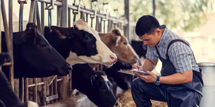
What the world’s largest provider of oilfield services has to say about innovation and regulation
5 years 6 months ago
Aileen Nowlan
What the world’s largest provider of oilfield services has to say about innovation and regulation
5 years 6 months ago
Here is something you don’t hear every day: oil and gas methane regulations can reinforce innovation and leadership. Numerous new methods to reduce oil and gas methane emissions are being developed; and regulators, environmentalists, oil companies and innovators are working together to craft a new way for innovation to be recognized and rewarded. I interviewed […]
Aileen Nowlan
Belize Nearly Triples the Size of its Marine Protected Areas
5 years 6 months ago
vdixon
Belize Nearly Triples the Size of its Marine Protected Areas
5 years 6 months ago
In a bold step for the sustainability of its fisheries and the world’s second largest barrier reef, the government of Belize has approved a plan to set aside 10% of its territorial waters as no-take marine protected areas (MPAs), nearly tripling the size of its existing zones.
vdixon
Belize Triples the Size of its Marine Protected Areas
5 years 6 months ago
vdixon
Belize Triples the Size of its Marine Protected Areas
5 years 6 months ago
In a bold step for the sustainability of its fisheries and the world’s second largest barrier reef, the government of Belize has approved a plan to set aside 10% of its territorial waters as no-take marine protected areas (MPAs), tripling the size of its existing zones.
vdixon
Energy storage market booms, with more growth to come
5 years 6 months ago
Environmental Defense Fund
What the world’s largest provider of oilfield services has to say about innovation and regulation
5 years 6 months ago
Something you don’t hear every day: oil and gas methane regulations can reinforce innovation and leadership. Numerous new methods to reduce oil and gas methane emissions are being developed; and regulators, environmentalists, oil companies and innovators are working together to craft a new way for innovation to be recognized and rewarded. I interviewed Drew Pomerantz […]
Aileen Nowlan
@EDFEnergyEX EDF Energy Program
5 years 6 months ago
“FirstEnergy hoped to simply walk away from a steaming pile of expensive, hazardous waste. Thankfully, today’s decision makes clear that the company can’t avoid its environmental responsibilities.” - @dickmunsonhttp://edf.org/F5w
Investors Urge Companies To Support Methane Regulations. Are They Listening?
5 years 6 months ago
amymorse
Investors Urge Companies To Support Methane Regulations. Are They Listening?
5 years 6 months ago
Over the past few weeks, companies like BP, Equinor, Exxon and Shell have publicly stated their support for direct federal regulation of methane. It is not every day that a company will ask for more rules rather than less. What’s one of the driving forces behind these public position reversals? Investors. Investors have been an […]
amymorse
Three lessons from Cuba about improving coastal climate resilience
5 years 6 months ago
Cuba recognizes the value of a measurable, communal and ecosystem-based approach to building climate resilience. Its approach can offer valuable lessons for coastal communities worldwide, including here in the U.S.
The post Three lessons from Cuba about improving coastal climate resilience first appeared on Growing Returns.Katherine Angier
Three lessons from Cuba about improving coastal climate resilience
5 years 6 months ago
Cuba recognizes the value of a measurable, communal and ecosystem-based approach to building climate resilience. Its approach can offer valuable lessons for coastal communities worldwide, including here in the U.S.
Katherine Angier
Bird-Brained Nonsense Blowing in the Wind
5 years 6 months ago
Written by Ronnie Citron-Fink
We know President Trump doesn’t like wind power. This week he stepped up his attacks against the renewable energy source, claiming wind turbines decrease property values, and the noise from the structures cause cancer. “If you have a windmill anywhere near your house, congratulations, your...
Ronnie Citron-Fink
EDF analysis: Lead service lines in Illinois communities
5 years 6 months ago
Tom Neltner
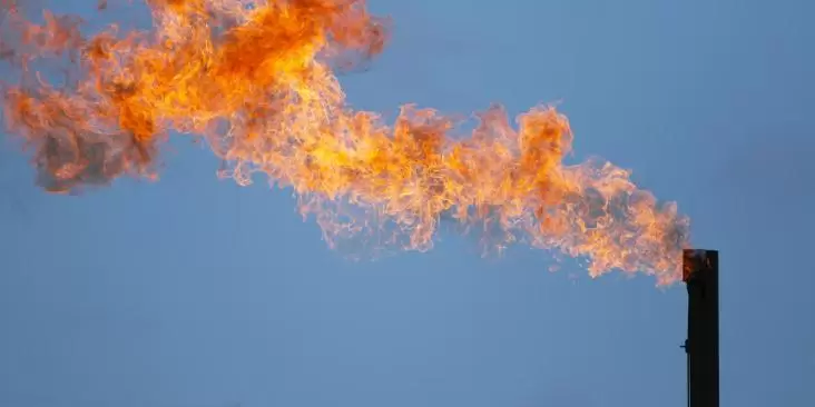
These pollution-spotting satellites are just a taste of what's to come
5 years 6 months ago
These pollution-spotting satellites are just a taste of what's to come
The most advanced satellite to ever launch from Africa will soon be patrolling South Africa's coastal waters to crack down on oil spills and illegal dumping.
Data from another satellite, this one collecting images from the Texas portion of a sprawling oil and gas region known as the Permian Basin, recently delivered shocking news: Operators there are burning off nearly twice as much natural gas as they've been reporting to state officials.
With some 5,000 satellites now orbiting our planet on any given day, a growing number of images captured from space are shedding new light on the world's mounting environmental challenges. It helps explain why organizations and corporations are beginning to use satellites to track deforestation, pinpoint methane leaks and show impacts of climate change.
Coming soon: A satellite that will map climate pollution on EarthWhat we're looking at here is, of course, just the beginning.
As countries such as Brazil and Indonesia seek to reduce deforestation, and nations like Mexico try to rein in emissions from oil and gas production, satellites will become indispensable. They will help create a constantly innovating industry that will revolutionize environmental monitoring of our planet and hold polluters accountable.
Data shed new light on Texas gas problemSatellites provide the geographical scope and precision needed to identify and assess problem areas that were previously unknown or poorly measured. Importantly, they will be able to measure changes on land, in oceans and in the air over time.
Thanks to satellites, we now have that actionable data on pollution from oil and natural gas wells that contribute to greenhouse gas emissions at a time when we must act quickly to curb climate change.
A recent study by Environmental Defense Fund focused on natural gas flares from the wells in the Permian Basin, located in Western Texas and southeastern New Mexico. Our analysis proved that the region's pollution problem was much larger than companies had revealed.
A second study about offshore gas flaring in the Gulf of Mexico, published by a group of scientists in the Geophysical Research Letters, showed that operators there burn off a whopping 40% of the natural gas they produce.
And that's not all.
Methane-probing satellite takes off soonSoon a new satellite will be launching that is specifically designed not just to locate, but accurately measure methane emissions from human-made sources, starting with the global oil and gas industry.
MethaneSAT, a new EDF affiliate unveiled last year, will launch a future where sensors in space will find and measure pollution that today goes undetected. This compact orbital platform will map and quantify methane emissions from oil and gas operations almost anywhere on the planet at least weekly.
The data MethaneSAT collects will help companies and countries identify emission sources, see opportunities to reduce them, and track those reductions over time. The data will be available to the public at no cost, so that we all can make sure both industry and governments are getting the job done.
That is the promise of satellite technology and what we call the Fourth Wave of environmentalism: It reveals, measures, monitors and motivates.
Get innovation updatesWe'll send regular updates about developments in technology, science and the environment.
Thank you for subscribing to the Climate Tech Brief.
krives April 4, 2019 - 10:12krives
These pollution-spotting satellites are just a taste of what's to come
5 years 6 months ago
These pollution-spotting satellites are just a taste of what's to come
The most advanced satellite to ever launch from Africa will soon be patrolling South Africa's coastal waters to crack down on oil spills and illegal dumping.
Data from another satellite, this one collecting images from the Texas portion of a sprawling oil and gas region known as the Permian Basin, recently delivered shocking news: Operators there are burning off nearly twice as much natural gas as they've been reporting to state officials.
With some 5,000 satellites now orbiting our planet on any given day, a growing number of images captured from space are shedding new light on the world's mounting environmental challenges. It helps explain why organizations and corporations are beginning to use satellites to track deforestation, pinpoint methane leaks and show impacts of climate change.
Coming soon: A satellite that will map climate pollution on EarthWhat we're looking at here is, of course, just the beginning.
As countries such as Brazil and Indonesia seek to reduce deforestation, and nations like Mexico try to rein in emissions from oil and gas production, satellites will become indispensable. They will help create a constantly innovating industry that will revolutionize environmental monitoring of our planet and hold polluters accountable.
Data shed new light on Texas gas problemSatellites provide the geographical scope and precision needed to identify and assess problem areas that were previously unknown or poorly measured. Importantly, they will be able to measure changes on land, in oceans and in the air over time.
Thanks to satellites, we now have that actionable data on pollution from oil and natural gas wells that contribute to greenhouse gas emissions at a time when we must act quickly to curb climate change.
A recent study by Environmental Defense Fund focused on natural gas flares from the wells in the Permian Basin, located in Western Texas and southeastern New Mexico. Our analysis proved that the region's pollution problem was much larger than companies had revealed.
A second study about offshore gas flaring in the Gulf of Mexico, published by a group of scientists in the Geophysical Research Letters, showed that operators there burn off a whopping 40% of the natural gas they produce.
And that's not all.
Methane-probing satellite takes off soonSoon a new satellite will be launching that is specifically designed not just to locate, but accurately measure methane emissions from human-made sources, starting with the global oil and gas industry.
MethaneSAT, a new EDF affiliate unveiled last year, will launch a future where sensors in space will find and measure pollution that today goes undetected. This compact orbital platform will map and quantify methane emissions from oil and gas operations almost anywhere on the planet at least weekly.
The data MethaneSAT collects will help companies and countries identify emission sources, see opportunities to reduce them, and track those reductions over time. The data will be available to the public at no cost, so that we all can make sure both industry and governments are getting the job done.
That is the promise of satellite technology and what we call the Fourth Wave of environmentalism: It reveals, measures, monitors and motivates.
Get innovation updatesWe'll send regular updates about developments in technology, science and the environment.
Thank you for subscribing to the Climate Tech Brief.
krives April 4, 2019 - 10:12krives