


Methodology
How we estimated New Mexico methane emissions
EDF estimate: Method for estimating upstream oil & gas methane emissions
EDF estimated total annual methane emissions from upstream oil and gas (O&G) sites in New Mexico, including well pads, gathering stations and gathering pipelines. Emissions were estimated for the year 2019 using a combination of site-level measurement data from previously published studies and satellite measurements from a recent paper.
Emissions were estimated using two different methods: a basin-level (or top-down) estimate and a source-level (bottom-up) estimate.
Basin-level production emissions
Production emissions were estimated for the Permian, San Juan and Raton basins using different methods.
For the San Juan and Raton basins, baseline emissions estimates were developed for 2017, described here, and then adjusted for 2019. We obtained 2017 active well counts and production data from Enverus/DrillingInfo, a subscription database that compiles well data from regulatory agencies including the New Mexico Oil Conservation Division. We grouped wells into production sites based on reported surface wellhead locations and a 50-meter cluster radius. Total production-site emissions by county were estimated by multiplying site counts by site-level emission factors (EFs).
EFs were calculated with a gas production dependent, log-normal equation based on the methods outlined in Alvarez et al 2018, section S.1.1. The underlying data are from >400 site-level measurements from six U.S. basins (Barnett, Fayetteville, Marcellus, Uintah, Upper Green River, Denver-Julesburg). In summary, maximum likelihood, analysis was used to integrate site-level data into a lognormal, two-term power law function that accounts for the weak effect of gas production on emissions. This previously published analysis resulted in a national average EF of 1.5 (1.1 – 1.9) kg CH4 h-1. Although the underlying data do not include site-level measurements from New Mexico, Alvarez et al 2018 reports that analogous estimates of San Juan Basin 2015 emissions agree closely with basin-level, aircraft-based measurements from the region (Smith et al 2017), suggesting that this combined dataset is broadly representative of the region. For the San Juan and other smaller basins, the central estimate EF of 1.5 kg CH4 hr-1 was applied.
This process yielded basin-level emissions for the San Juan and Raton basins for 2017. Emissions for 2019 were calculated by multiplying the 2017 basin-level emissions by the ratio of 2019 to 2017 gas production (production was relatively constant in both basins).
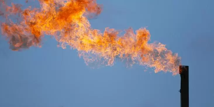
For the Permian, emissions estimates were based on satellite measurements from the Tropospheric Monitoring Instrument (TROPOMI) (Zhang et al. 2020). Zhang et al. found a natural gas leakage rate of 4.1% for the Delaware sub-basin of the Permian from May 2018 to March 2019. We assume this leakage rate is constant for all of 2019. Using 2019 production data from Enverus/DrillingInfo and an assumed methane content of 78.8%, we calculate basin-wide emissions for the Permian to be 740,000 metric tons of methane in 2019.
Emissions by source category
Emissions by source category had previously been calculated for each basin for 2017, incorporating EPA Greenhouse Gas Reporting Program (GHGRP) data as described below. When the 2019 inventory was being compiled, GHGRP was not yet available for 2019 (it has since been released). Therefore, to update this analysis to 2019, the relative contribution of each source category to the total basin-wide emissions was assumed to remain constant between 2017 and 2019. Thus, the 2019 emissions totals were multiplied by the percent contributions for each source category to yield source-level estimates for 2019 for each basin.
EDF estimated production emissions by source category using a combination of data sources, including the EPA GHGRP and previously published measurement studies. Source-level emissions were estimated using similar methods as reported in Alvarez et al 2018 for the alternative inventory (section S1.4). In summary, GHGRP data were analyzed with a statistical model that uses production data and reported basin-level emissions to estimate county-level emissions from both reporters and non-reporters. For some sources, we use GHGRP activity data and other emissions data to estimate emissions. For example, pneumatic controller emissions are based on adjusted GHGRP controller counts and emission factors from Allen et al. 2014.
The difference between basin-level and aggregate source-level emissions was attributed to “abnormal process conditions” (see Zavala-Araiza et al. 2017). This includes malfunctions and other issues that lead to high emission rates that are not accounted for by traditional source-level inventory methods. It is important to note that our source-level emission estimates are intended to approximate how empirically derived total emissions are allocated among sources based on independent, source-level data. Our “abnormal process conditions” category may include additional emissions that are released from reported source categories like tanks due to potential issues with GHGRP data, such as systematically underreported control efficiencies.
Gathering and boosting
For the gathering and boosting segment, total methane emissions from gathering stations, pipelines, and blowdowns were estimated according the methods outlined in Alvarez et al 2018, section S.1.1. In summary, we estimated station emissions from gas production and percentage loss rates based on ~100 previously published site-level measurements (Marchese el al 2015). As reported in Alvarez et al, the loss rates from Marchese et al were adjusted slightly upward (~17%) to account for sites above the sampled range. Gathering blowdown emissions were based on episodic emissions reported in Marchese et al. Gathering pipeline emissions were based EPA Greenhouse Gas Inventory EFs; these EFs are based on data from local distribution pipeline leaks and are highly uncertain.
Estimating VOCs
EDF estimated the total annual emissions of volatile organic compounds (VOCs) based on the estimated methane emissions inventory. In order to account for variations in gas composition across the state, EDF converted methane to VOCs using basin and source-specific CH4:VOC ratios from a 2016 Western Regional Air Partnership (WRAP) report.
Additional documentation on this analysis is available.
EPA estimates: Method for identifying state-level estimates from basin-level reporting
Oil and gas companies are required to report methane emissions annually to the US EPA Greenhouse Gas Reporting Program if their annual greenhouse gas emissions exceed 25,000 metric tons CO2e. For onshore production and gathering and boosting (G&B), emissions are reported at the basin level. As basins often cross state boundaries, the US EPA is unable to provide precise state-level emission estimates. For the 2019 reporting year, there were 83 onshore production and 62 G&B facilities reporting emissions in three basins located at least partially within New Mexico counties: the Permian, San Juan, and Las Vegas-Raton. EDF estimated reported emissions attributable to New Mexico by allocating basin-level emissions by the fraction of 2019 O&G energy production from the New Mexico portion of each basin (35%, 68% and 23%, respectively).
Lost Revenue: Method for estimating lost revenue from methane emissions and flared natural gas
Well sites were categorized based on land ownership: federal, state, private, or tribal (using BLM New Mexico surface ownership data). Wellsites were further classified to identify sites on state trust lands. (Not all state lands are included in the state trust, and the state trust includes wells where subsurface ownership belongs to the state trust and surface ownership to a different entity. See New Mexico State Land Office).
Site-level production emissions were then summed for each land type (federal, state, private, tribal and state trust) to generate production percentages by land type. Because flared gas volumes are included in the revenue calculation (described below), vented and flared production emissions are set to zero to avoid double counting. Combustion emissions are also set to zero as these emissions are often seen as necessary. Methane emissions are converted to volumes of natural gas using a volumetric-methane content value of 78.8% for production emissions.
Flared gas volumes are from the NOAA VIIRS 2018 dataset (2019 data is not yet available. As flaring has increased from 2018 to 2019, the choice of 2018 is conservative). Flare locations were categorized based on land ownership, using the same methodology and land ownership data described above. Flared volumes were then summed for each land type: federal, state, private, tribal, and state trust. The volumes of wasted natural gas from production emissions (categorized by land type) were added to the flared volumes of natural gas, also classified by land type.
The lost revenue from these volumes of natural gas was calculated based on the following assumptions (see Oil and Natural Gas Taxing in New Mexico):
- The royalty rate for production on federal lands is 12.5%, of which 49% is returned to the state.
- The royalty rate for production on state trust lands varies by lease. An economist for natural resources on the New Mexico Legislative Finance Committee estimated (via a private phone call) that on average, the royalty rate is 19% for natural gas.
- The following taxes are assessed on gas production on all land types:
- 4% emergency school tax
- 3.75% severance tax
- 0.24% conservation tax
- Approximately 1% ad valorem tax (slight differences based on land type)
- Any allowable deductions (of which there are many) are ignored in this analysis, and the lost revenue values should be viewed as estimates.
- Federal royalties (of which 49% are returned to the state) are already assessed on flared gas from federal lands in the Permian basin. This value was subtracted from the federal lost state revenue estimate.
- Revenue is calculated based on a $2.57/MMBtu natural gas price (the average 2019 Henry Hub gas price) using a heat value of natural gas of 1,037 Btu/ft3 to convert natural gas volumes (Henry Hub U.S. natural gas heat content).
Projecting emissions through 2025
Using the EDF estimated inventory, we projected emissions forward under a Business as Usual (BAU) scenario, using the Rystad oil and gas production projections for New Mexico, to generate the best available representation of future changes in BAU methane emissions.
We then assigned a growth profile (Oil, Gas, or Oil & Gas) for each source category based on the most representative resource projection. For example, fugitive leak emissions were tied to total oil & gas projections, while compressors were tied to the natural gas projections. Using this method, we were able to project forward the estimated emissions for each source category under a BAU scenario.
Additionally, we used DrillingInfo to establish a turnover rate of existing to new wells year-to-year by examining recent well turnover rates in New Mexico. We calculated an estimated annual turnover rate of 2%. This allowed us to assess the allocation of emissions (by year and source category) between new sources and existing sources in order to model those reductions for new wells.
In addition to the updates to the inventory and underlying data, an earlier version of the tool (released July 2019) contained an error in emissions projections that has been corrected in this version.
Calculating reductions from the state’s proposed rules
EDF conducted an analysis of the potential impacts of the proposed New Mexico Environment Department (NMED) and Oil Conservation Division (OCD) rules. Percent reductions were estimated for each source category. However, the NMED rule contains two exemptions for wells that apply to both those with a potential-to-emit (PTE) of less than 15 tons per year (TPY) of VOCs and stripper wells on both the number of facilities that would be subject to the rule's control requirements. Per our analysis, the exemptions carve out 95% of wellheads and production sites in the six counties subject to the proposed NMED rule and a significant percent of emissions. This percent exempted was applied in the model when determining the impact of the state’s proposed rules.
EDF analyzed the impact of the low producing well exemption by examining the number of facilities in the NMED permit/NOI database (https://gis.web.env.nm.gov/oem/?map=methane) and calculating the number of facilities that fall below the proposed PTE threshold. NMED requires facilities with regulated emissions above 25 TPY to have an air permit. Oil and gas facilities are required to submit a Notice of Intent (NOI) if they have regulated air contaminant emissions above 10 TPY. The permit and NOI database includes potential to emit (PTE) for VOC emissions; use of these data shows that 2,398 wellheads and production sites have a VOC PTE above 15 TPY VOC. Using data from DrillingInfo, EDF determined the total number of oil and gas facilities in New Mexico to be roughly 43,100. Therefore, roughly 95% of wellheads and production sites in NM will be below the 15 TPY VOC threshold and will be exempted from the rule.
To calculate the impact of the stripper well exemption on the number of covered facilities, EDF pulled well data from Enverus/DrillingInfo. Wells were clustered into well sites based on a 50 m radius. Average oil production (bbl/day) and average gas production (Mcf/day) were calculated on a per well basis. If the average oil production was less than 10 bbl/day/well or the average gas production was less than 60 Mcf/day/well, a well site was determined to be a stripper well. Virtually all stripper wells also fall under the 15 TPY threshold.
Covered and exempt well sites are shown in the Explorer tab of this digital report. Location data for covered well sites were taken directly from the NMED permit/NOI database for those well sites with PTE above 15 TPY. These data were overlaid with the well site location data from Enverus/DrillingInfo in order to display both covered and exempted well sites.